


In the name of God
In this article, we intend to introduce you to the historical and tourist places of Malayer. Stay with us.
Malayar is a historical city in western Iran that is also the center of Malayer County. This city is located 360 kilometers west of the capital (Tehran) and 75 kilometers southeast of the provincial center (Hamedan).
The importance of Malayer goes back to the historical areas around it. There are several thousand-year-old historical monuments around Malayer, which show the rich history and civilization of this city. This city has made significant progress in the contemporary era and is the largest city in the province after Hamedan. In the following, we will introduce the most important and most attractive historical and tourist places of Malayer County along with their geographical coordinates (location).
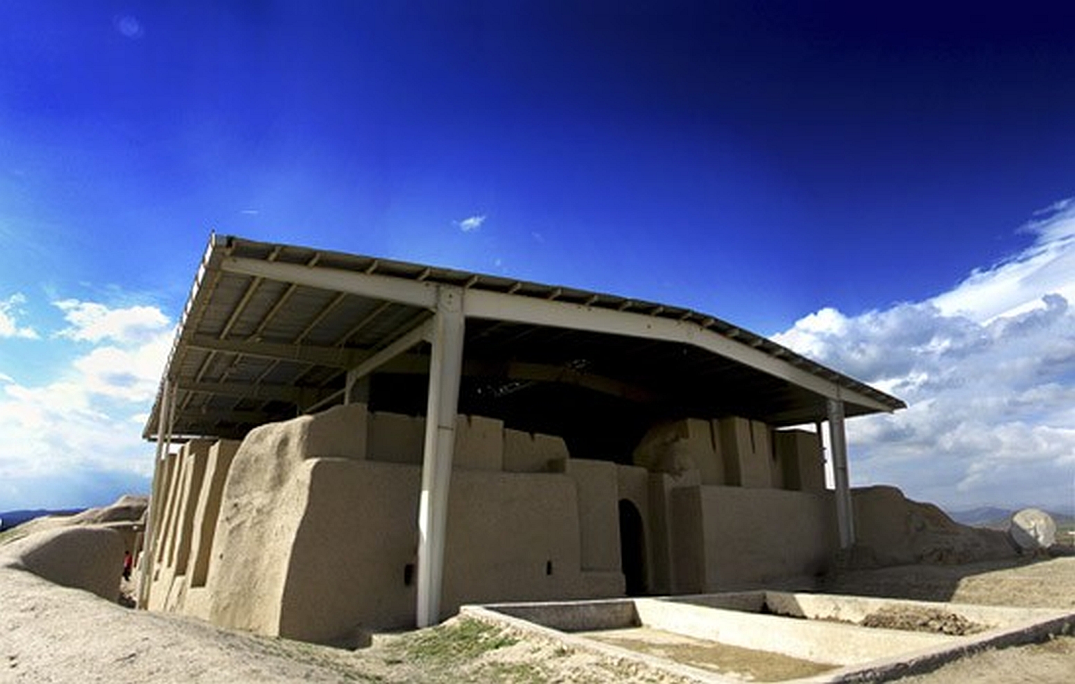
1- Noushijan Fire Temple:
This fire temple, which is located on a historical hill with the same name and inside the oldest brick building in the world, is located 20 kilometers northwest of Malayer city and near the village of Shushab. This work was registered on February 20, 1967 with registration number 763 as one of the national works of Iran.
Geographic coordinates: longitude 48.633005 and latitude 34.365490
Souvenir shopping has always been considered one of the entertainments and attractions along with travel and tourism. Malayer Souvenirs Store has brought this attraction to your homes so that you, dear ones, can purchase your favorite souvenir by visiting our store site at https://malayersoghat.ir
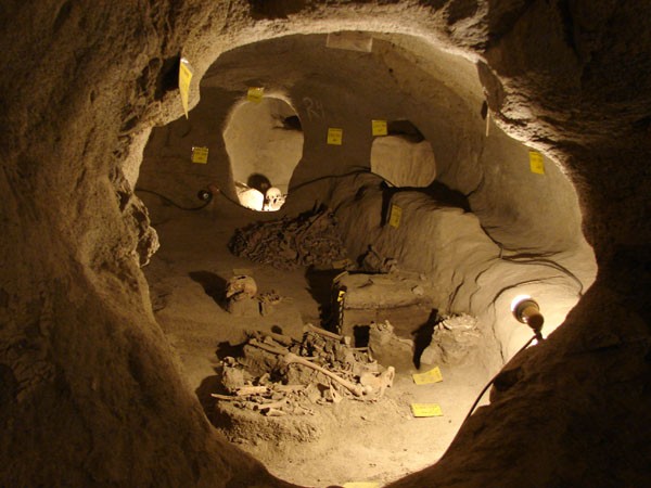
2- Samen Underground City
10 kilometers southwest of Malayer County, in Saman City, lies a city hidden in the heart of the earth. The architecture and historical age of this city speak volumes about the greatness and history of Malayer County. The Saman Underground City, with an area of over three hectares, was dug into the heart of the earth by the Iranian ancestors before the Parthian period. The Saman Underground City is one of the unique relics left over from the pre-Parthian era, and its age of about 3,500 years speaks volumes about the greatness of this work.
Geographical coordinates: longitude 48.703466 and latitude 34.209644
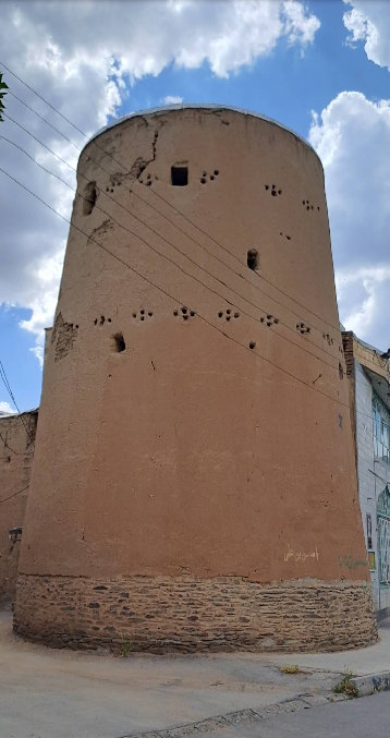
3- Khangholi Tower of Samen
Khangholi Tower is from the Ilkhanian period and is located in Malayer County, Samen District, Samen City, Chaleh Khangholi neighborhood. This ancient monument, which was registered in the National Monuments of Iran on 18/11/2008, is known as one of the sights of Malayer. This brick and mud tower dates back to about 700 years ago and the diameter of its foundations is about 15 meters. This tower was originally built in 4 floors, but during World War I and during the Russian attack, its upper floor was destroyed by cannons. The first and second floors of the tower are made of clay and have a hipped roof. The third and fourth floors are made of raw brick and mud and have a flat wooden beam covering. The body of these floors has lattice holes that, in addition to being decorative, are intended for shooting at enemies.
Geographic coordinates: Longitude 48.7048901 and latitude 34.210095
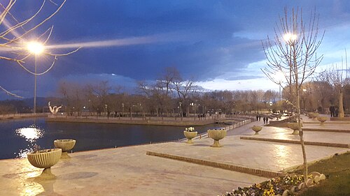
4- Seyfieh Malayer Historical Park and Recreation
Seyfieh Malayer Park (Seyfieh Historical Garden) is one of the oldest endowed parks in the country, which was established in 1304 by the descendants of Abdul Mohammad Mirza Seyfodowleh, one of the grandsons of Fath Ali Shah Qajar, who was the ruler of Malayer province until his death in 1300, according to his will. This park was built in the northeast of Malayer and on the slopes of Mount Garmeh. Its area is about 10 hectares. This beautiful park has old plane trees to create shade, ponds and fountains, and an artificial forest on the hills.
Seyfieh Park has two pools, a mosque, and a building that was Seyfodowleh's residence. The water it needed was transferred to the park area from the surrounding mountains through the construction of a canal 8 kilometers from Zarak by the Mughnian of Yazd. The Seif al-Dawla Park and Tomb Complex has been registered as the Iranian Garden in the list of historical and national monuments of Iran.
Geographic coordinates: longitude 48.838639 and latitude 34.299503
5- Baam Malayer
The Baam Malayer Recreation and Tourism Complex is one of the largest and most beautiful tourist projects in the city of Malayer and Hamedan province, which welcomes travelers from all over the country and even the world every year. An area in the heights of the Malayer hot spring where you can see the entire city from there and enjoy the mountain air of the city of Malayer. If you also want to travel to the historical city of Malayer, which is also known as the world city of grapes, furniture and carvings, go with Malayer Souvenirs.
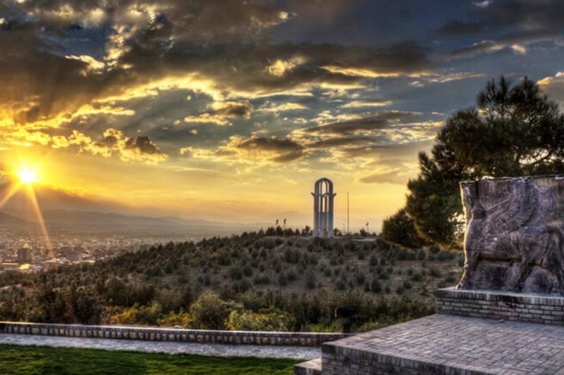
Geographical coordinates: Longitude 48.840653 and latitude 34.306406
6- Mini World Complex of Malayer
Mini World Park of Malayer is one of the unique tourist attractions of Iran, located in the northern part of this city. This miniature park with an area of more than 48 hectares is not only the first theme park of Malayer, but also the first mini tourism complex in the Middle East and the fourth in the world. Visiting this park is a unique opportunity to see 138 historical, national and world monuments on a small scale.
This park allows you to see all domestic and foreign tourist attractions at once without having to travel to different countries. In a way, you can kill two birds with one stone and enjoy visiting this Mini World Park and the miniature historical and tourist monuments of Iran and the world in addition to traveling to beautiful Malayer.
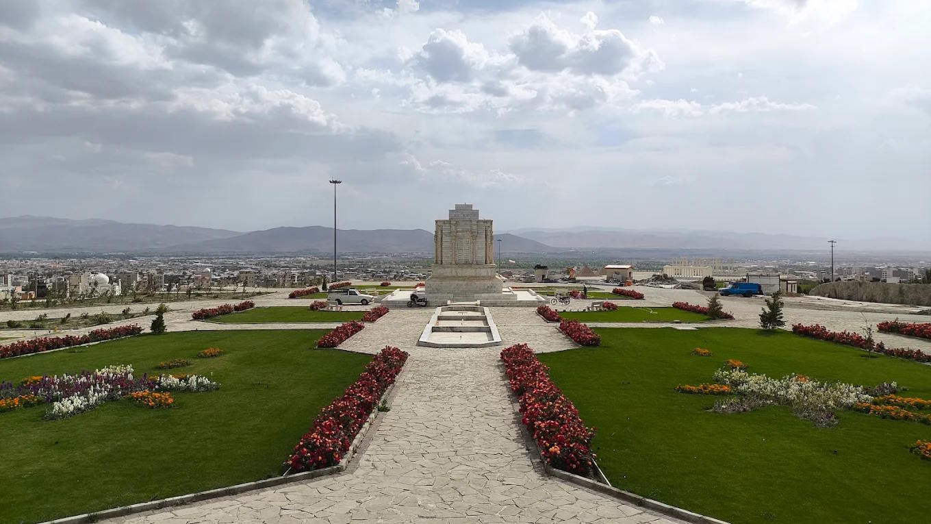
Geographical coordinates: Longitude 48.813767 and latitude 34.315433
7- Mirfatah Glacier
This glacier belongs to the Qajar period and was built by a person named Mirfatah. Glaciers are seen in most cities of Iran, where they were used to keep water cool. However, this glacier is one of the few brick glaciers, and in the west of the country there is only this example, the Mirfatah Glacier.
Domed buildings are very vulnerable to long and heavy rainfall, which is why the dome of this glacier collapsed after the long rainfall of the spring of 2019 and the penetration of water and the weight of the snow on it. After this incident, the Cultural Heritage of Hamadan Province took action to reconstruct it, and now this building is under reconstruction.
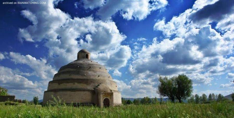
Geographical coordinates: longitude 48.809825 and latitude 34.286503
8- Aqgol Wetland
Aqgol is the name of a wetland located 20 kilometers northeast of Malayer County. This lagoon is famous for its location one kilometer from a village called "Eslamshahr Aqgol". The best time to visit this beautiful lagoon is in late winter and early spring, which has a very beautiful and unique landscape and scenery. Bird migration during these times is one of the most important reasons for creating these beauties, which attract many tourists and travelers to this region of the country.
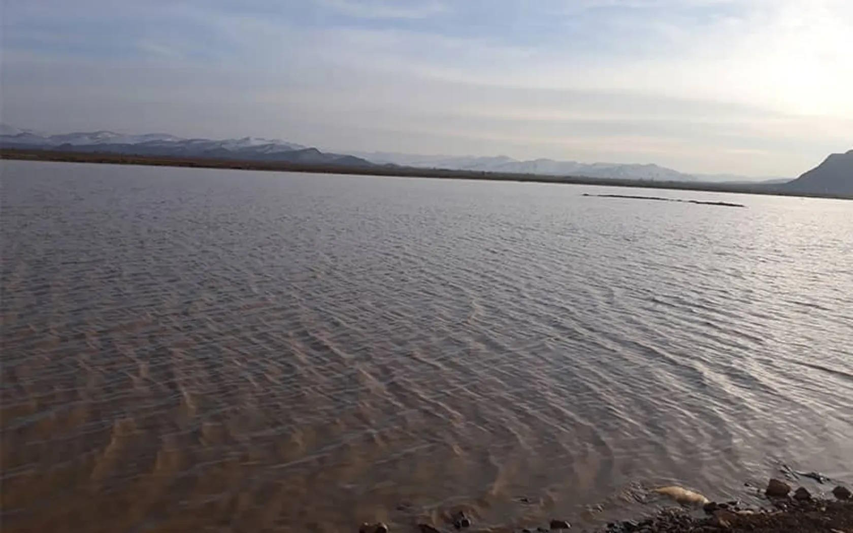
Geographical coordinates: Longitude 49.017056 and latitude 34.533917
9- Lotfalian Malayer Culture and History Museum
Lotfalian Malayer House
In Malayer County, located in Hamedan, where traces of history can be easily found in its back alleys, there are many historical houses, one of which is considered a relic of the Qajar era. Lotfalian Malayer House is a place where traces of history, art, and culture are rooted in its bricks; from old Iranian architecture and ancient objects to various collections and lamp-making decorations.
History of Lotfalian House
During the reign of Fath Ali Shah Qajar, Mosaddeq al-Mamalek, due to his kinship with the court, managed to employ the master architects of that era to build his dream house. Initially, this house had three parts: the interior, the Hasina, and the stables, which was reserved for religious affairs, but after Morteza Khan Lotfalian bought this house, he turned the Hussainiyeh into a beautiful house, and over the following years, his family lived in this house. For this reason, this house became known as Lotfalian House. Finally, the Cultural Heritage Administration purchased this house from its owner in 2004 and changed the use of the house to a museum after its restoration.
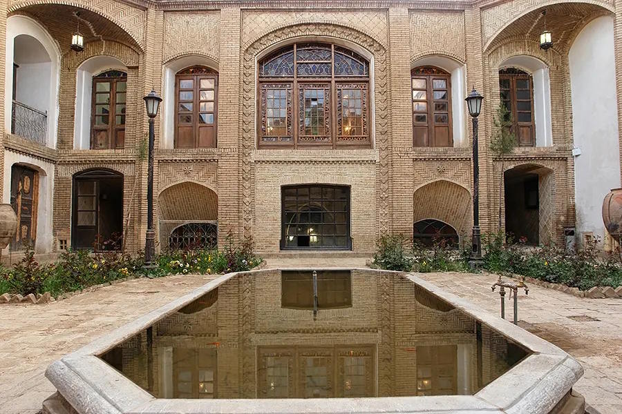
Geographical coordinates: Longitude 48.822675 and Latitude 34.287748
10- Kausar Park and Artificial Lake
Kousar Park in Malayer is one of the unique parks with a suitable space for children's recreation and family relaxation, located at the entrance to Malayer. The word Malayer is composed of two parts, Mal and Ayer, and means the land of fire. The nature of Malayer is very pristine and beautiful due to its location in the foothills of the Zagros Mountains. In the middle of the park, an artificial lake called Lake Kosar stands out like a jewel. This lake, which occupies an area of about 2 hectares, is very suitable for boating. Due to the appropriate space and the provision of recreational and welfare facilities such as the bird garden, cultural complex, amusement park and waterfall in Lake Kosar, it is considered one of the tourist places in the city of Malayer, which every year and in all seasons, many tourists, including travelers and residents of the city, choose Lake Kosar Malayer for their recreation.
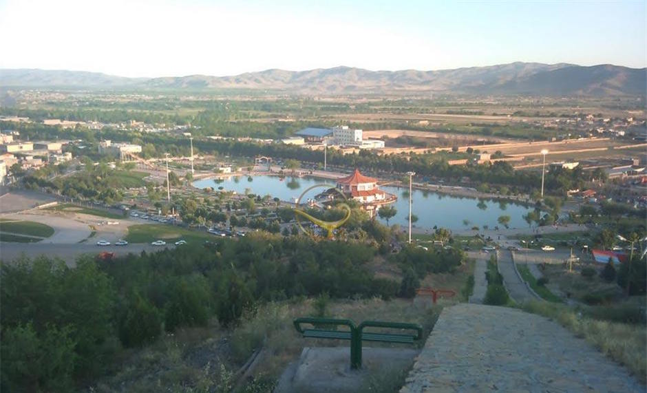
Geographic coordinates: Longitude 48.788143 and latitude 34.316385
11- Gorab Historical Fortress and Castle
Gorab Fortress is located in Gorab village, one of the villages of Malayer County in Hamedan Province, which is part of Iran's history and identity. This fortress is located east of the Malayer-Arak road. According to archaeological studies conducted in 2006, the age of the layers was determined by carbon-14 testing on organic materials in the fortress. The first layer belongs to the 5th millennium BC, the second layer belongs to the 6th and 7th millennia AD, and the third layer dates back to the Bronze Age. After these, works can be found that are related to the Achaemenid, Parthian and Sassanid periods, as well as the Islamic period. Which includes objects related to the Islamic period, early Islam of the Seljuk and Ilkhanid periods.
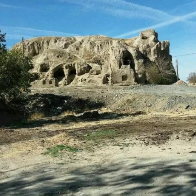
Geographic coordinates: longitude 48.865040 and latitude 34.226010
12- Lashgardar Protected Area, Malayer
Malayar is a mountainous city with a breathtaking nature. Towering mountains, vast and endless plains, deep valleys, and roaring rivers are all natural attractions of Malayer, which makes many tourists choose Malayer as their travel destination. The General Directorate of Environmental Protection of Hamadan Province has introduced parts of Malayer's natural areas as protected areas for further preservation and protection. Lashgardar and Golparabad are two protected areas in Malayer County that are home to many birds and animals. Lashgardar Protected Area is located in the east and southeast of Malayer, around the villages of Darreh Jozan to Pari Zanganeh, and covers an area of about 15,550 hectares. Among the plant species in this area, which are very beautiful and eye-catching, are the inverted tulips.
Along with travel and tourism, souvenirs and souvenir shopping have always been considered one of the entertainments and attractions. Malayer Souvenir Store has brought this attraction to your homes so that you, dear ones, can buy your favorite souvenir by visiting our store site at https://malayersoghat.ir.

Geographical coordinates: longitude 48.981270 and latitude 34.207490
13- Golparabad Protected Area
Golparabad Protected Area is located in Malayer County, Hamadan Province. This area, with an area of 8,326 hectares, is located about 40 kilometers southeast of Malayer and has been introduced as a protected area due to its rich biodiversity.
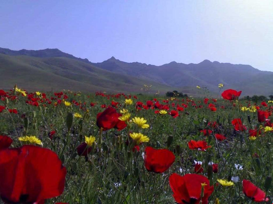
Geographic coordinates: Longitude 49.090690 and latitude 34.183380
14- Pari Castle
Pari Castle is an ancient site in Pari village (Pirouz) of Malayer County, which is known as the birthplace of Karim Khan Zand, the founder of the Zand dynasty. The castle is located near the Malayer-Arak highway.
In addition to its historical importance due to the birth of Karim Khan Zand, Pari Castle is also notable for its more than 150 old tombs, as well as its unique water supply system and its similarity to the Fin Bath in Kashan.
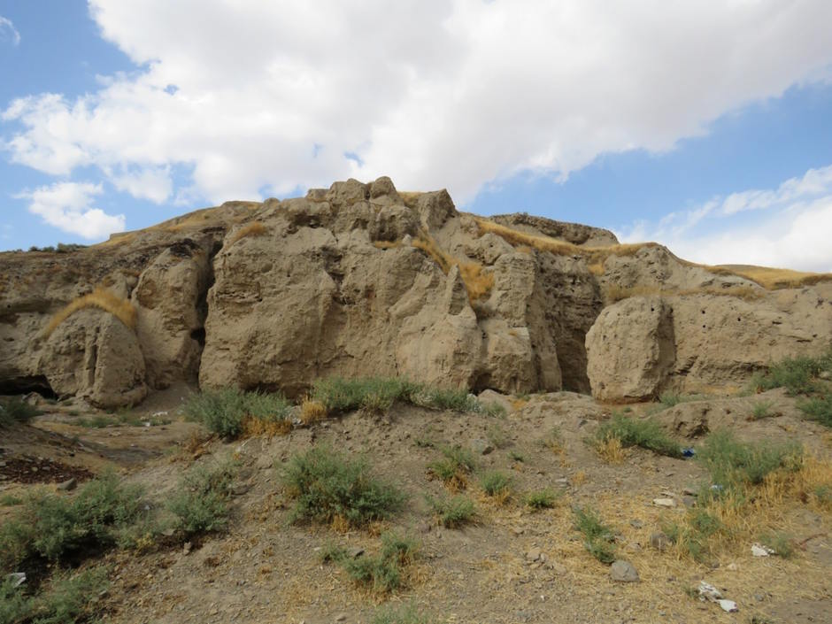
Geographic coordinates: Longitude 49.043180 and latitude 34.135040
15- Enoch Castle
Historians and archaeologists consider the Enoch Castle to be from the 6th century BC. This 8,000-year-old castle is a strong fortress, despite damage in various parts of it. Excavation work in the vicinity of the castle to dig tunnels has destroyed parts of the castle. These tunnels have been dug by people over time as a secret route to escape from the enemy. Due to its long history, Anuj Castle is made of simple and primitive materials such as bricks and mud. The aqueducts dug in this castle have old carvings. The oldest aqueduct in the complex is called Ezzatullah Khani Aqueduct, on the southern side of which you can see carvings.
Along with travel and tourism, souvenirs and souvenir shopping have always been considered one of the entertainments and attractions. Malayer Souvenir Store has brought this attraction to your homes so that you, dear ones, can buy your favorite souvenir by visiting our store site at https://malayersoghat.ir.
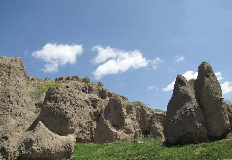
Geographic coordinates: Longitude 48.575610 and latitude 34.107810
16- Seif al-Dawla Tomb
Abdul Mohammad Mirza Seif al-Dawla, son of Sultan Ahmad Mirza Az-al-Dawla, was a descendant of Fath Ali Shah Qajar who stayed in Malayer city during his journey from Kermanshah to Tehran. After the trip, he decided to buy Malayer city from the government and allocate the income from the city to build a hospital. Seif al-Dawla Garden and Tomb is located in the northeast of Malayer and at the end of Park Boulevard. Seif al-Dawla built a house and a mosque in a garden with an area of 10 hectares located on the slopes of Mount Garmeh. The name of this garden was named Seif al-Dawla Garden in honor of the efforts of its founder so that its name would remain eternal.
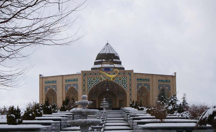
Geographic coordinates: Longitude 48.838050 and latitude 34.296760
17- Pirvashe Spring, Jozan
Malayar County has an extraordinary and beautiful nature. One of the beautiful areas around Malayer is the Pirvashe region, which has a natural spring and is considered one of the sights of Malayer. With its natural springs, lush forests, and abundant vegetation, Pirvashe is a great place for recreation, tourism, and mountaineering in the summer.
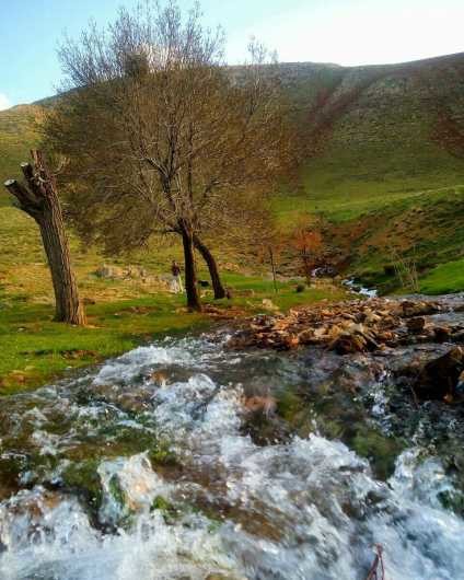
Geographic coordinates: Longitude 48.958480 and latitude 34.231060
18- Malayer Grand Dam
The Grand Dam is a dam in western Iran located 30 kilometers south of Malayer city. The Malayer Grand Dam is the largest dam in Hamedan Province. Initial executive and technical studies of this dam began in 2001 and construction operations began in June 2003. The main use of this dam was to provide drinking water for Malayer city and agricultural water for the villages of Malayer county. Another prominent use of this dam is as one of the recreational and residential attractions of the region.
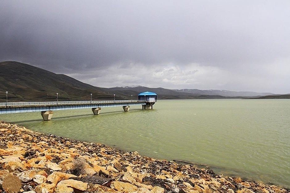
Geographic coordinates: longitude 48.902926 and latitude 34.049541
19- Baba Hussein Tomb Tower
The Baba Hussein Tomb, also known as the Tomb of Hazrat Yusha ibn Noah, is a historical tomb tower in Malayer County, Hamedan Province. This historical monument is located in the village of Siah Kemer, about 55 kilometers west of Malayer. The tomb most likely dates back to the sixth to eighth centuries AH and has been registered as one of the national monuments of Iran.
Along with travel and tourism, souvenirs and souvenir shopping have always been considered one of the entertainments and attractions. Malayer Souvenir Store has brought this attraction to your homes so that you, dear ones, can purchase your favorite souvenir by visiting our store site at https://malayersoghat.ir.
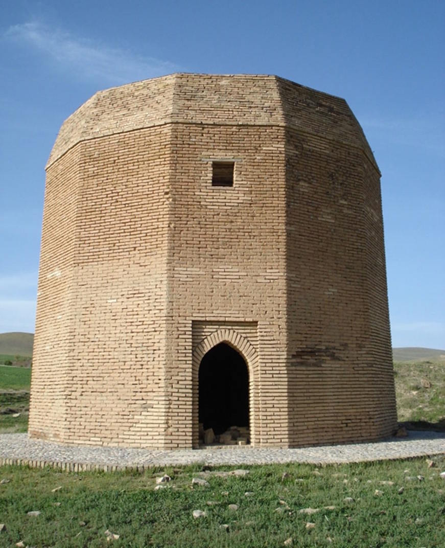
Geographic coordinates: Longitude 48.577040 and Latitude 34.181100
20- Nanaj Grand Mosque
The village of Nanaj is one of the historical villages of Malayer. Nanaj is a village in the Jokar district, 20 kilometers northeast of Malayer city, on the way from Malayer to Hamedan. The Grand Mosque of Nanaj village, which dates back to the Qajar era, is another old mosque in Malayer city. It has been registered in the list of cultural heritage and tourism of Iran.
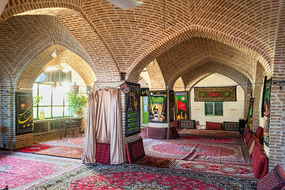
Geographical coordinates: longitude 48.753090 and latitude 34.420540
In addition to travel and tourism, souvenirs and souvenir shopping have always been considered one of the entertainments and attractions. Malayer Souvenir Store has brought this attraction to your homes so that you, dear ones, can buy your favorite souvenir by visiting our store site at https://malayersoghat.ir.
Contact us to book eco-tourism accommodations
You can also message us on WhatsApp
Contact us via WhatsApp to buy Malayer souvenirs
Phone Number
989197777191 .png)
Click here to download the comprehensive Malayer tourism guide file.
بستن *نام و نام خانوادگی * پست الکترونیک * متن پیام |
.png)
.png)
.png)
.png)
.png)
.png)
.png)


.png)
.png)